―Special Photo Story―

I put this page here for the sake of a Russian researcher (*)
(who inquired of me about Japanese megaliths such as "The Kanayama Megaliths")
and others who might be interested in the field of
Lost Civilizations/Prehistoric Heritages, Megaliths and Archaeoastronomy,
etc.
October 17, 2003 KOMATSU, Eisei
(*) The Door to the Past: Archaeoastronomy and the Pyramids
1.The Toujin Field―An Unfortunate History
-
The Toujin Field ("Toujin Daba" in Japanese) once had the feature
of both Avebury of England (photo.5) and Carnac of France (photo.6).
Alas, the local prefectural government (The Section for Conservation of
Nature!!) removed all the stones in the Field in order to make the place
as a park, in 1977.
Thus, the world's top-level pre-historic heritage was "destroyed"
except the Stone Circle surrounding the field.
-
The site is at the center of the vast Ashizuri Megalithic Area, which is in the mountain of Ashizuri Peninsula, west of Kochi Prefecture, Shikoku, Japan.
Lacking public transportation access and other reason (very far from most
populated area of Japan and even far from the center of Kochi Pref.), people
rarely visit the site even after the birth of the pretentiously respectable
park.
-
As it is the case at Avebury and Carnac, nobody knows the exact purpose
and usage of the formation. However, as the word "toujin" implies
"alien", I assume that the site was constructed and used by the
different type of humans (a group of people, to come and leave time after
time, well versed in handling huge stones) than the local residents.
(Please click each thumbnail photo to get a larger image.)
1.airview, before 2.overlook, before 3.airview, after 4.overlook, recent 5.Avebury 6.Carnac
-
(Airview, Before the "Destruction") June 13, 1959
During some time after World War 2, people of the vicinity cultivated the
Field for food, but the stone alignments were left untouched.
-
(Overlook, Before) Just before the 1977 "destruction": Taken from the Toujin Stones; Recently found picture
Some of the stone alignments (estimated 17 rows altogether) are clearly
visible in the Field (the major axis: 185 meters).
-
(Airview, After) Oct.24, 1977: At the completion of the "destruction"
Practically nothing in the Field.
-
(Overlook, Recent) Nov.4, 2000: Taken from the Toujin Stones
Beyond the Toujin Field (220 meters above sea level) one can see the Pacific
Ocean. The Stone Circle is coverd by bamboo grasses.
2.The Toujin Stones
1.congeries 2.congeries 3.smooth surface 4.concave surface
-
As the pictures of the Toujin Field suggest, the Toujin Stones ("Toujin
Ishi" in Japanese) site is very close to the Field.
A large number of huge stones are gathered and piled up in this relatively
narrow area.
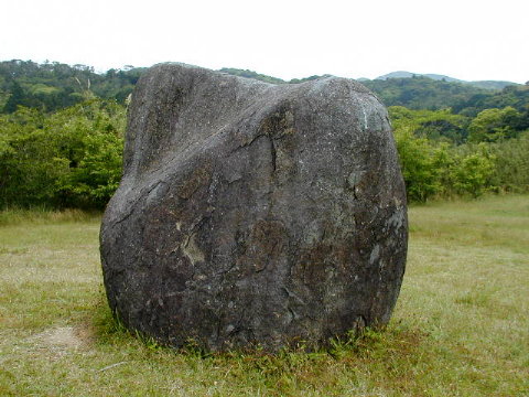
Some of the stones, like photo.3 and photo.4, seem to have been left half-finished.
3.Other Ashizuri Megaliths
1.supporting wedge 2.triplet 3.foundation 4.crescent 5.arranged
6.stone mound
-
It is up to the readers how to interpret these pictures, as no systematic
and intensive research has been conducted so far, except some partial ones.
And a research itself could become an imperfect one if it lacks the relevant
viewpoint in the first place.

[Top of this page]
Photo Gallery(1)“The Natural Beauty
of the Earth”
Photo Gallery(2)“Scenery of the Earth”
Photo Gallery(3)

Copyright© 2003 Eisei KOMATSU
[Copyright of Pictures]
NASDA (National Space Development Agency of Japan): "Ashizuri Peninsula"
Forestry Agency (Ministry of Agriculture, Forestry and Fisheries of Japan):
"1.airview, before"
Martin Gray (http://www.sacredsites.com/index.htm): "5.Avebury"
Confirmation pending: "2.overlook, before", "3.airview,
after"
Eisei KOMATSU: "The Symbol Stone", "4.overlook, recent"
and "6.Carnac" of "The Toujin Field", All the pictures
of "The Toujin Stones" and "Other Ashizuri Megaliths"


![]()